
AND is a conjunction, connective or conjoining word. It signifies that a word or part of a sentence is to be added to what precedes. Thus, give me an apple and an orange; that is, give me an apple, add or give in addition to that, an orange. John and Peter and James rode to New York, that is, John rode to New York; add or further, Peter rode to New York; add James rode to New York.
Word of the Day: Catachrestical
1. A particle which expresses the relation of connection or addition. It is used to conjoin a word with a word, a clause with a clause, or a sentence with a sentence.
2. In order to; -- used instead of the infinitival to, especially after try, come, go.
3. It is sometimes, in old songs, a mere expletive.
4. If; though. See An, conj.
Doubt; uncertainty.
Andalusia
Encyclopedia Britannica
ANDALUSIA, or Andalucia, an extensive region in the south of Spain, bounded on the N. by New Castile and Estremadura, on the W. by Portugal, on the S. by the Atlantic and the Mediterranean, and on the E. by the Mediterranean and Murcia. Although no longer officially recognised, yet, like the other ancient divisions of Spain, it is probably better known and oftener referred to, at least in popular language, than the modern provinces which have been formed out of it. These are eight in number— Seville, Huelva, Cadiz, Jaen, Cordova, Granada, Almeria, Malaga. It also corresponds to the “four kingdoms”— Seville, Jaen, Cordova, and Granada — into which the Moors divided the south of Spain, to the still older Roman province of Boetica, and probably, in part at all events, to the Tarshish of the Bible, a famous trading emporium and district belonging to the Phoenicians, who were the earliest known inhabitants of the country. The name Andalusia is said to be a corruption of Vandalusia, from the Vandals, who overran this part of Spain after the downfall of the Roman Empire; other authorities, however, consider that the Moors, who occupied the country after the Vandals, gave it its present name from their term Andalosh, “land of the West.” Andalusia has an area of about 33,000 square miles, and in 1867 had a population of 3,200,944. The principal river of Andalusia is the Guadalquivir, the Roman Boetis, which rises in the mountains of Jaen, and flows in a south-westerly direction to the Mediterranean at San Lucar. Its chief aflluents are the Jandula, the Guadiata, and the Huebla on the right, and the Xenil on the left. Among the other rivers of the province are the Tinto, the Guadalete, and the. Guadaljorce. The country is very mountainous; the chief ranges are the ...Sierras Morena and de Arsohe in the north, the Sierra Susana in the centre, and the Sierras Nevada, de Gador, and Bermeja in the south. There are several peaks of great elevation; among the highest are Mulahacen (11,781 feet) and Picacho de la Veleta (11,597 feet), both in the Sierra Nevada. Many of the mountains abound with metals, as silver, lead, copper, iron, and with coal; while marble and quartz are also found, the former in large quantities, and of a fine quality. Though its soil and climate vary with the elevation of the land, Andalusia must be considered the finest and most delightful of all the divisions of the peninsula. Some of the higher mountains are covered with perpetual snow, a luxury which is highly prized by the inhabitants of the valleys, where the summer is usually extremely hot, and in winter the snow falls only to melt when it reaches the ground. Here the more common European plants and trees give place to the wild olive, the caper bush, the aloe, the cactus, the evergreen oak, the orange, the lemon, the palm, and other productions of a tropical climate. On the coasts of the Mediterranean, about Marbella and Malaga, the sugar-cane is successfully cultivated; and no inconsiderable quantity of silk is produced in the same region. Agriculture is in a very backward state, and the implements used are of the most primitive description; nevertheless, owing to the natural richness of the soil, large crops of wheat and other cereals are grown. There are, however, considerable tracts of land which, from want of water, are neither cultivated nor inhabited; these occur chiefly in the west of the province. The horses and bulls of Andalusia are celebrated all over Spain; sheep and swine are extensively bred, and game is abundant The inhabitants are a lively, good-humoured, and ready-witted people, fond of pleasure, lazy, and extremely superstitious, great boasters, and, Like most boasters, very cowardly and unwarlike. The men are tall, handsome, aud well-made, and the women are among the most beautiful in Spain; while the dark complexion and hair of both sexes, and their peculiar dialect of Spanish, so distasteful to pure Castilians, are as evident traces of the long rule of the Moors, as are the magnificent architectural remains which adorn many of the Andalusian towns.
9th ed. Encyclopædia Britannica, vol. 2, p. 10
[698 words — estimated reading time: 4 minutes]
[698 words — estimated reading time: 4 minutes]
A massive mineral, of a flesh or rose red color; sometimes found crystallized in imperfect four-sided prisms, nearly or quite rectangular. Its hardness is nearly equal to that of Corundum, and it is infusible by the blow pipe. It has its name from Andalusia, in Spain, where it was first discovered.
Andaman islands
Encyclopedia Britannica
ANDAMAN ISLANDS. These islands lie in the Bay of Bengal, 590 geographical miles from the Hoogly mouth of the Ganges, 160 miles from Cape Negrais in British Burma, the nearest point of the mainland, and about 340 from the north extremity of Sumatra. Between the Andamans and Cape Negrais intervene two small groups, Preparis and Cocos; between the Andamans and Sumatra intervene the Nicobar Islands, all seeming to indicate a submarine range stretching in a curve, to which the meridian forms a tangent, between Cape Negrais and Sumatra; and though this curved line measures 700 miles, the widest sea-space is less than 90. Some zoological facts are held to point to the former existence of continuous land from Negrais to Achin Head. If we can accept the doubtful authority of Wilford, Hindu legends notice this remarkable chain, and ascribe it to Rama, who attempted here first to bridge the sea, an enterprise afterwards transferred to the south of India, and accomplished at the place we call Adam’s Bridge.
The main part of the group is a band of four islands, so closely adjoining, end to end, but slightly overlapping, that they have long been known as one, viz., “the Great Andaman.” The axis of this band, almost a meridian line, is 156 statute miles long. The four islands are (north to south)—North Andaman, 51 miles long; Middle Andaman, 59 miles; South Andaman, 49 miles; and Rutland Island, 11 miles. Of the three straits which part these four islands, the two most southerly, Macpherson’s and Middle Straits, though narrow are navigable. Andaman Strait, between Middle and North islands, is at low water a fetid swampy creek, not passable by a boat....
Little Andaman, 30 miles by 17, forming the southern extreme of the group, is detached from Great Andaman by Duncan Passage, 28 miles in width. One considerable island (Interview Island) lies immediately west of Great Andaman, and many islets are scattered round. The highest point in the group is Saddle Mountain, in North Andaman, approaching 3000 feet. From this southward the hills sink in height.
People. — These islands, so near countries that have for ages attained considerable civilisation and have been the seat of great empires, and close to the track of a great commerce which has gone on at least 2000 years, continue to our day the abode of savages as low in civilisation as almost any known on earth. Our earliest notice of them is in that remarkable collection of early Arab notes on India and China which was translated by Eus. Renaudot, and again in our own time by Μ. Reinaud. It accurately represents the view entertained of this people by mariners down to our own time. “The inhabitants of these islands eat men alive. They are black, with woolly hair, and in their eyes and countenances there is something quite frightful They go naked, and have no boats.
If they had, they would devour all who passed near them. Sometimes ships that are windbound, and have exhausted their provision of water, touch here and apply to the natives for it; in such cases the crews sometimes fall into the hands of the latter, and most of them are massacred.” The traditional charge of cannibalism has been very persistent; but it is entirely denied by themselves, and rejected by all who have taken part in our recent colony. Of their massacres.of shipwrecked crews, there is no doubt; such horrors have continued to our own day on these islands, as well as on the Nicobars.
The people are Oriental Negroes, and idle stories were once current of their descent from wrecked cargoes of African slaves. Races of somewhat like character are found in the mountains of the Malay peninsula (Semangs) and in the Philippine group (Ajitas or Aetas'); there is reason to believe a similar race exists in the interior of Great Nicobar; there are recent rumours of the like in Borneo; and, strange to say, late reseaτch has shown a possibility of near connection with the Andamanners of the aboriginal race of Tasmania, recently extinct—circumstances which seem to indicate a former diffusion of this variety of mankind over a large space of the south-eastern world. But, in truth, accurate comparison of these tribes has yet scarcely been attained. The Andaman countenance has generally impressed Europeans at first as highly repulsive, and as African in character; but when we come to particulars, it has usually neither the exaggerated blubber-lip, nor to a like extent the prognathous profile, of the true Negro; nor has the Andamanner the Negro's large or ill-formed feet. The ear is small and well-formed; the hair glows in short detached tufts, curled in small rings close to the head, but is declared not to be woolly. (There are tribes of a long-haired race on Interview Island, and it is also said on Rutland. These are of superior stature, and may have been modified by alien blood from shipwrecked crews.) The skin is of a lustrous black; the people, especially the men, are often robust and vigorous, though their stature is low—seldom 5 feet, and generally much less. In this respect they can look down on the Cape Boschmen alone. The general resemblance of countenance ascribed to the people in some accounts is entirely denied by those who have become familiar with them. Professor Owen, in a skull which he examined, found none of the distinctive characters of the African Negro. The people, as a rule, are absolutely devoid of clothing. The men’s nearest approach to it is to twist a few fibres round the forehead or neck, or below the knee; the women sometimes make a slight attempt at decent covering with leaves or tails of plaited fibre—the last appearing to be only a modern innovation, and the result of partial contact with our settlement. Adult males are alleged to be tattooed, or rather cicatrised (though photographs do not confirm the universality of this). The process begins about the age of eight, and goes on at intervals. It used to be done with a flint; now usually with bottle-glass. Till the process is complete, the youth is ineligible for marriage. With both sexes all hair is shaven off, except a narrow strip from crown to nape, which is kept cut close. The men rarely have beard, and in general their eye-lashes are few. The people are neither long-lived nor healthy. Indeed, few are believed to pass forty. They suffer especially from fevers, colds, and lung complications; but also from bowel complaints, headache, toothache, abscesses, and rheumatism. The malarious influence of newly cleared jungle affects them as violently as Europeans. Formerly their almost sole remedial treatment was to coat themselves in whole or part with mud and turtle-oil. This mud daubing in various forms is also used' as mourning, and as a protection against musquitoes or the sun’s rays. Paint made from ferruginous red earth is used as a decoration. Of late the natives round the colony appreciate quinine highly.
They have nothing whatever approaching to agriculture, nor does their rude shelter of leaves deserve the name of hut. Their chief food in the hot season consists of turtle, wild fruits, and honey, which they procure with great dexterity. In the rains the seeds of an Artocarpus are a staple, and in the intermediate season the wild hog; when the hog becomes scarce, fish and turtle. They have large appetites: a man will consume 6 lb of fish at a sitting, and soon be ready to begin again. At their haunts kitchen-middens are formed from bones and shells till the stench becomes unbearable; then they shift quarters. Col. Man mentions a kitchenmidden at Hope Town 15 feet high and nearly 50 in diameter, almost exclusively composed of shells. They seem kindly among themselves, and capable of strong attachments; and though irritable, they are not vindictive. They are very fearless, and are formidable archers, shooting strongly and truly with a bow between 5 and 6 feet long, of tough wood, hard to bend. They shoot and harpoon fish w ith skill, and catch it also by hand; and have hand-nets, and stake-nets for turtle.
Monogamy seems the rule. A young man proclaims himself a candidate for marriage by eating a special kind of fish (a species of ray), whilst marriageable girls wear certain flowers. The young man, if a pig-hunter, abstains from pork for a year; if a turtlehunter, from turtle; and during the probationary year honey is forbidden. The wife provides shelter and mats to lie on, does the cooking (all food is cooked), procures water and shell-fish, carries loads, shaves and paints her husband, and tends him when sick. The husband protects his wife, makes canoes, weapons, &c., and sometimes goes in search of food; but this generally devolves on the unmarried. They pet their children, but many perish. A family of three living children is rare. If an adult dies, he is quickly buried, and the tribe migrates 8 or 10 miles for about a month. Some months later the bones, as they dry, are taken up, and these, the skull especially, are carried about by the kinsfolk—for how long we are not told. Mourning is shown by a daily daubing of olive mud, particularly a thick coat on the head. It lasts a month. During their sorrow they are silent, refrain from red paint and decoration, and from much food, especially from pork and honey; but have daily to throw a piece of honey-comb into the fire.
A notable eccentricity with these people is crying, as an utterance of emotion. It is an expression of reconciliation with enemies, and of joy at meeting friends after long separation. Something similar is known in New Zealand, and, it would seem, among the Patagonians. When two Andaman tribes meet under such circumstances, the new-comers begin the process, the women weeping first; their men then take up the lugubrious function; finally, the tribe on whose ground the scene occurs reciprocate, commencing with their women. This doleful antistrophe is continued long—“sometimes through several days ”—and then they take to dancing!
They are said to have no idea of a God or future state, though Colonel Symes in his narrative gives a different acoount, and perhaps information on this point is still too imperfect. We find reference made to their belief that evil spirits cause disease, and to their dread of the ghosts of the dead.
They were always very hostile to strangers, repulsing all approaches with treachery, or with violence and showers of arrows. This may have originated in ancient liability to slave raids. Not till five years after the establishment of Port Blair colony did they begin to abate hostility. Robberies were frequent, and the murder of persons straying into the woods. The Government established homes for the aborigines in the environs of the settlement—viz., sheds for shelter, with some aid in rations, &c., and this conduced to a better state of things. An orphanage also has now been established under European matrons.
They are perfect swimmers and divers, and expert in managing canoes. These are neatly formed, and, according to Mouat, some are fitted with outriggers, which enable them to go seaward for considerable distances. Two centuries ago, according to Captain A. Hamilton, they used to make hostile descents on the Nicobars, and this is confirmed by a Nicobar tradition mentioned in the Asiatic Researches But there is apparently no later evidence of such expeditions, and they were probably confined to March and April, when the sea is generally like a pond.
The number of aborigines is unknown, and conjecture has varied from 3000 up to 10,000, or even 15,000. Dr Mouat, in 1857, whilst steaming rapidly round the islands, everywhere saw natives in considerable numbers, and was induced to believe that the older and lower estimates had been much under the truth; but there is reason to believe that the population is on the coast only. They are divided into tribes or groups, not usually containing more than thirty individuals; and among these the country is partitioned in some fashion, for we are told that trespasses are a common ground of war between tribes. Each tribe has a dépôt, or headquarters, where the sick are tended and surplus stores are kept.
The name Mincopie is applied to the Andaman race in books, originating with a vocabulary given by Lieutenant Colebrooke. One suspects some misunderstanding about this. Of the language we have as yet little information. It is said to be very deficient in words, and there is the tendency usual in the circumstances to strong dialectic differences. Thus the people of Little Andaman are said not to understand those of South Andaman. Those near the settlement begin to incorporate English and Hindustani words. It is stated positively that they have no numerals. It was once believed that they had no proper names, but this proves erroneous. The child is named before birth; hence names seem of common gender, and as they are few—some twenty in all—a special epithet is prefixed to each, personal or local in origin.
Climate.— This is very moist, as might be expected. The islands are exposed to the full force of the south-west monsoon of summer, and also in some seasons share that rainy effect of the north-east monsoon of the late autumn which characterises the Coromandel coast in the same latitude. Hence Colonel Kyd, who was chief of the settlement abandoned in 1796, says only four months’ fair weather could be counted on, and a later explorer uses nearly the same phrase. The natives divide the year into three seasons—(1.) The dry, literally “the northern sun,” February to May; (2.) The rainy, June to September; (3.) The moderate season, October to January. There is, however, rather a remarkable want of uniformity in the seasons. The rainfall at Port Blair for four years is reported as follows :— [table]
The annual mean temperature, reduced to sea-level, is about 81° Fahr.
Geology, &c.— The islands appear from the sea as a series of low hills. These being covered with dense and lofty forest, we have as yet little information on the geology. The surface is excessively irregular, and the islands are toe narrow to have rivers. There has been no alluvial deposit, and in many places the rocky formation is bare. Near our settlement in South Andaman the principal rocks are grey tertiary sandstones, identical with those prevailing in Aracan. This sandstone affords excellent building material. Traces of coal have been found, but only small pockets in the sandstone, without seam. Serpentine rock occurs on the east coast south of Port Blair, and on Rutland. A broad strip of indurated chloritic rock extends from Port Blair north-north-east to the east coast of Middle Andaman, Coral reef barriers gird the islands on all sides. The general dip of the rocks is to the westward, and thus the depth of sea on the east is much greater. On the west the corals are continuous and very extensive, forming patches of reef even 20 or 25 miles from shore. Agate flakes have been found on the site of an old encampment. It is curious that Captain A. Hamilton speaks of an adventurer known to him who made money by quicksilver obtained from these islands, but no confirmation of this has been reported. No fossils have yet been got.
Vegetation.— On the east the prevailing character is of forest trees with straight stems of 100 feet in mean height, often entirely covered with climbing plants. On the west vegetation is not so lofty. Deciduous trees are everywhere sporadic, and large tracts of them occur, robbing the landscape in the hot season of its tropical richness by their grey sterile aspect. These trees are generally of little utility. Bombax malabaricum is abundant among them. The immense buttressing of the stems of many of the trees is notable. Extensive tracts are also occupied by bamboo jungle, 30 to 35 feet high, almost entirely of Bambusa andamanica, from which lofty forest trees stand out, very far apart. The bamboo seems to attach especially to the indurated chloritic rock. Mangrove swamps fringe the little bays and straits, with many orchids. Behind the swamps are palms, Phoenix paludosa and Licuala paludosa; also Barringtonia and Excoecaria Agallocha, recognised by their red decaying leaves in June and July, and Lager- stroemia and Pterocarpus by their rich lilac or yellow blossoms. Arborescent euphorbias, screw-pines, and a Cycas of considerable height, give a remarkable aspect to the coast vegetation in many places. Above these are the coast forests, on the slopes of hills, and valleys influenced by the sea. Mimusops indica, believed to be a very valuable wood, forms whole forests; sometimes in equal proportions with Hemicyclia andam. Around these are tropical mixed forests, through which it is hard to force a way from the multitude of climbers. Dipterocarpus lcevis is the typical tree here. Palms are numerous— e.g., Licuala peltata and Areca triandra. On one small island (Ter-mooklee) there is a gigantic Corypha with leaves 30 feet long, but stemless. The high forests of the interior are little known. The quantity of intricate climbers is less, and the uniformity of vegetation greater. Treeless spots are confined to craggy islands completely exposed to wind and weather. The general character of the vegetation is Burmese, altered by some unfavourable circumstances, principally the scarcity of running water. But there are also· a number of Malayan types not found on the adjacent continent. There are no tree ferns, apparently. There are a considerable number of edible wild fruits. No indigenous coco-palms exist, though these are so plentiful on the adjoining Cocos and Nicobars. Much of the scenery of the islands is very beautiful.
Animal Life.— This is greatly deficient throughout the whole group, especially as regards Mammalia, of which the species are very few. There is a small pig (S. andaman-ensis), important to the food of the people—perhaps that found on the Nicobars; a Paradoxurus; a rat with spiny hairs (if. andam.); a small frugivorous bat (Cgnoρterus marginatus). A “wild cat” is alleged, but there seems doubt about it. No Quadrumana have been seen. Of birds several species seem peculiar to this group, or to the Nicobars, or to the two together; and some of the Andaman species are considered by Mr Blyth to accord better with corresponding species at a distance than with those on the adjoining part of the continent. Thus, Artamus and Oriolus of the Andamans seem identical with those of Java, not with those of India or Burma; and a shrike of these islands agrees better with a species of China and the Philippines than with the nearest species in Bengal, Aracan, and the Malay peninsula. Caves on the coast are frequented by the swift, which forms the edible nest of the China market. Pigeons, kingfishers, and woodpeckers are numerous. Reptiles are pretty numerous, both as regards species (15 to 20) and individuals, including eight Ophidia and several Geckoes, of which four or five are peculiar. Among these is one (Phelsuma andam.) the immediate kindred of which is known only in Madagascar and the adjoining islands. The Indian toad is common. Turtle are abundant, and now supply Calcutta. The species of fish are very numerous, and many are peculiar. They have been especially studied by Dr F. Day. It is much to be desired that these islands should have a thorough scientific exploration whilst the type of their productions is still substantially uninfluenced by foreign agency.
History.— It is uncertain whether any of the names of the islands given by Ptolemy ought to be attached to the Andamans; yet it is probable that this name itself is traceable in the Alexandrian geographer. Andaman first appears distinctly in the Arab notices of the 9th century, already quoted. But it seems possible that the tradition of marine nomenclature had never perished; that the ΆγαΘοΰ t>atμovos vησos was really a misunderstanding of some form like Agdamdn, while Νήσοι Βαρούσσαι survived as Lanka Bâlûs, the name applied by the Arabs to the Nicobars. The islands are briefly noticed by Marco Polo, who probably saw without visiting them, under the name Angamanain, seemingly an Arabic dual, “The two Angamans,” with the exaggerated but not unnatural picture of the natives, long current, as dog-faced Anthropophagi. Another notice occurs in the story of Nicolo Conti (circa 1440), who explains the name to mean “Island of Gold,” and speaks of a lake with peculiar virtues as existing in it (the natives do report the existence of a fresh-water lake on the Great Andaman). Later travellers repeat the stories, too well founded, of the ferocious hostility of the people; of whom we may instance Cesare Federici (1569), whose narrative is given in Ramusio, vol. iii. (only in the later editions), and in Purchas. A good deal is also told of them in the vulgar and gossipping, but useful work of Captain Hamilton (1727). In 1788-89 the Government of Bengal sought to establish...
9th ed. Encyclopædia Britannica, vol. 2, p. 11
[4,154 words — estimated reading time: 25 minutes]
[4,154 words — estimated reading time: 25 minutes]
Moving moderately slow, but distinct and flowing; quicker than larghetto, and slower than allegretto.
A movement or piece in andante time.
Rather quicker than andante; between that allegretto.
Pertaining to the Andes. The great chain of mountains extending through S. America.
Pertaining to the Andes.
Andelys
Encyclopedia Britannica
ANDELYS (Les), a town in the department of Eure, France, formed by the union of Le Grand and Le Petit Andely, which are situated, the latter on the eastern bank of the Seine, and the former nearly half a mile from the river, at a distance of about 20 miles north-east of Evreux. Grand Andely, the older of the two, dates from the 6th century, and contains a collegiate church, whose stained-glass windows are remarkably beautiful. Petit Andely sprang up around the château Gaillard, which was built by Richard Coeur de Lion in 1195, and was formerly one of the strongest fortresses in France. The chief manufactures at Les Andelys are cloth, thread, and leather, and there is a considerable trade in grain and wool. Population (1872), 5379.
9th ed. Encyclopædia Britannica, vol. 2, p. 13
[131 words — estimated reading time: 1 minute]
[131 words — estimated reading time: 1 minute]
Andenne
Encyclopedia Britannica
ANDENNE, a town of Belgium, in the province of Namur, situated on· the right bank of the Meuse, 10 miles east of Namur. It contains no buildings of note, but is a place of considerable manufacturing activity. The principal productions are porcelain, tobacco-pipes, and paper, and in the neighbourhood are beds of pipe-clay and marble quarries. Population, 6370.
9th ed. Encyclopædia Britannica, vol. 2, p. 13
[60 words — estimated reading time: 1 minute]
[60 words — estimated reading time: 1 minute]
Andernach
Encyclopedia Britannica
ANDERNACH, a small town of Rhenish Prussia, situated on the left bank of the Rhine, 10 miles north-west of Coblenz. It is the Antunnacum of the Romans, and in the Middle Ages was a fortified town of considerable importance, but at the present day the walls only add to its picturesque appearance. Among the objects of interest are a lofty watch tower, the Coblenz gate, and the fine parish church, built in the beginning of the 13th century. Andernach has a trade in leather, corn, and wine; but its most noted articles of commerce are millstones, made of lava and of tufa-stone, which when pounded and mixed with lime, possesses the property of hardening under water, and has been much used by the Dutch as a cement in the construction of their dykes. Population about 4000.
9th ed. Encyclopædia Britannica, vol. 2, p. 13
[138 words — estimated reading time: 1 minute]
[138 words — estimated reading time: 1 minute]
Anderson
Encyclopedia Britannica
ANDERSON, Adam, a Scottish economist, was born in 1692, and died in London on the 10th January 1765. He was a clerk for forty years in the South Sea House, where he published a work entitled Historical and Chronological Deduction of the Origin of Commerce, containing a History of the Great Commercial Interests of the British Empire (1762, 2 vols, fol.) A third edition appeared in 1797-9, in four vols. 4to, the last volume being an appendix and continuation by the editor, Mr Walton.
ANDERSON, Alexander, an eminent mathematician, was born at Aberdeen about 1582. In his youth he went to the Continent, and settled as a private teacher or professor of mathematics at Paris, where he published or edited, between the years 1612 and 1619, various geometrical and algebraical tracts, which are conspicuous for their ingenuity and elegance. He was selected by the executors of the celebrated Vieta to revise and edit his manuscript works, a task which he discharged with great ability. He afterwards produced a specimen of the application of geometrical analysis, which is distinguished by its clearness and classic elegance. The works of Anderson amount to six thin 4to volumes, which are now very scarce. As the last of them was published in 1619, it is probable that the author died soon after that year, but the precise date is unknown....
ANDERSON, Sir Edmund, a younger son of an ancient Scottish family settled in Lincolnshire, was born at Broughton or Flixborough about 1540, and died in 1605. He was some time a student of Lincoln College, Oxford, and removed from thence to the Inner Temple, where he applied himself diligently to the study of the law, and became a barrister. In 1582 he was made lord chief-justice·of the common pleas, and in the year following was knighted. He was one of the commissioners appointed to try Queen Mary of Scotland in 1586. His works are—1. Reports of many principal Cases argued and adjudged in the time of Queen Elizabeth in the Common Bench, Lond. 1644, fol.; 2. Resolutions and Judgments on all the Cases and Matters agitated in all Courts of Westminster in the latter end of the reign of Queen Elizabeth, Lond. 1655, 4to.
ANDERSON, James, LL.D., was born at the village of Hermiston, in the county of Edinburgh, in the year 1739. At an early age he lost his parents, who were in humble life, but this did not interrapt his education, and being desirous to obtain an acquaintance with chemistry as a means of professional success, he attended the lectures of Dr Cullen. Enlarging the sphere of his employments, Anderson forsook the farm in Mid-Lothian which his family had occupied for several generations, and rented in Aberdeenshire a farm of 1300 acres of unimproved land. But previous to this he had become known to men of letters by some essays on planting, which, under the signature “Agricola,” he published in the Edinburgh Weekly Magazine, in 1771. After withdrawing from his northern farm, where he resided above twenty years, he settled in the vicinity of Edinburgh, and continued to interest himself in agricultural questions. In 1791 he projected a periodical publication called The Bee, consisting of miscellaneous original matter, which attained the extent of eighteen octavo volumes. It was published weekly, and a large proportion of it came from his own pen. From this period till 1803 he issued a number of publications chiefly on agricultural subjects, which had no small influence in advancing national improvements. Dr Anderson, after a gradual decline, partly occasioned by excessive mental exertion, died in 1808.
ANDERSON, James, a learned and industrious antiquary of Edinburgh, was born there August 5, 1662, and educated to the legal profession, in which he became a writer to the Signet. His reputation as a historian stood so high, that just before the Union the Scottish parliament commissioned him to prepare for publication what remained of the public records of the kingdom, and in their last session voted a sum of £1940 sterling to defray his expenses. At this work he laboured for several years with great judgment and perseverance; but it was not completed at his death in 1728. The book was published posthumously in 1739, edited by Thomas Ruddiman, under the title Selectus Diplomatum et Numismatum Scotiae Thesaurus. The preparation of this great national work involved the author in considerable pecuniary loss; and soon after his death, the numerous plates, engraved by Sturt, were sold for £530. These plates are now lost, and the book has become exceedingly scarce. After the union of the crowns, Anderson was appointed in 1715 postmaster-general for Scotland, as some compensation for his valuable labours; but in the political straggles of 1717 he was deprived of this office, and never again obtained any reward for his important services to his country.
ANDERSON, John, natural philosopher, was born at Roseneath in Dumbartonshire in 1726. In 1756 he became professor of Oriental languages in the University of Glasgow, where he had finished his education; but in 1760 he was appointed to the chair of natural philosophy, a subject more suited to his tastes and acquirements. In this department he laboured assiduously to apply scientific knowledge to the improvement of the mechanical arts, studying industrial processes in the various workshops of the city, and thus qualifying himself to be the scientific instructor of the artizan. He opened a class for the instruction of mechanics in the principles of their arts, in which his familiar extempore discourses were illustrated by appropriate experiments. He is thus to be regarded as the father of those Mechanics’ Institutions which have since become so common. His anxiety for the improvement of artizans was not confined to his personal exertions. Shortly before his death in 1796, he bequeathed the whole of his property to 81 trustees, for the purpose of founding an institution for educational purposes in Glasgow. He had seemingly intended it as a sort of rival to the univer sity in which he was himself a professor; for his will mentions the founding of four halls or colleges with nine professors in each, for the faculties of arts, medicine, law, and theology. But the trustees found the funds entrusted to them utterly inadequate to so gigantic a scheme; and they contented themselves with founding what is now called, in its official calendar, Anderson' 's University. This institution was opened in 1797, by the appointment of Dr Thomas Garnett as professor of natural philosophy, who commenced with a popular course of lectures, which was attended by a considerable audience of both sexes. In 1798 a professor of mathematics and geography was appointed; and the institution has since had the aid of many able teachers. In 1799 Dr Garnett was succeeded by Dr Birkbeck, who had the merit of introducing in the institution a system of gratuitous scientific instruction, given annually to 500 operative mechanics. On the removal of Dr Birkbeck to the London Royal Institution, he was succeeded by Dr Andrew Ure in 1804; and Dr Ure by Dr William Gregory. In recent years the institution has received several munificent endowments from private persons, and its staff of teachers has been consequently greatly strengthened. It now possesses a complete medical school, whose certificates are recognised by the various examining bodies both in England and Scotland. In 1872-3 there were 460 medical students, and 2508 persons in all attended the various classes of the institution.
ANDERSON, Robert, an author and critic of considerable note in his own day, was born at Carnwath, Lanarkshire, on the 7th January 1750. He was at first destined for the church, and was sent to the University of Edinburgh in 1707. After a few sessions, however, he quitted the divinity classes in order to study medicine. He was for a short time employed as surgeon to the dispensary at Bamborough Castle in Northumberland. Returning to Scotland he took the degree of M.D. at St Andrews, on the 20th of May 1778. He now began to practise as a physician at Alnwick; but his general habits were rather those of speculation than exertion, and a moderate provision, acquired by his marriage with the daughter of Mr John Gray, of Alnwick, had emancipated him from the necessity of professional labour. In 1784 he finally returned to Edinburgh, where he continued to reside till the close of his life. For several years his attention was occupied with his edition of The Works of the British Poets, with Prefaces Biographical and Critical (14 vols. 8vo, Edin. 1792-1807). His other publications were, The Miscellaneous Works of Tobias Smollett, M.D., with Memoirs of his Life and Writings (Edin. 1796); Life of Samuel Johnson, LL.D., with Critical Observations on his Works (Edin. 1815); The Works of John Moore, M.D., with Memoirs of his Life and Writings (Edin. 1820); and The Grave and other Poems, by Robert Blair; to τvhich are prefixed some Account of his Life and Observations on his Writings (Edin. 1826). Dr Anderson died on the 20th Feb. 1830.
9th ed. Encyclopædia Britannica, vol. 2, p. 14
[85 words — estimated reading time: 1 minute]
[85 words — estimated reading time: 1 minute]
Andes
Encyclopedia Britannica
ANDES. The Andes form a mountain chain second only to the Himalayas in the vastness of its proportions, and possessing many remarkable peculiarities. The origin of the name appears to be unknown, although numerous meanings have been authoritatively assigned to it. It has been variously supposed to be derived from the Peruvian words Anta, or tapir; Anti, meaning metal or copper; and Antis, the name of a tribe resident in the mountains; or from the Spanish Andenes, applied to the gardens on the terraces which occur on the western slopes of the Andes in Chili. Humboldt believes its meaning has been lost. In connection with this may be noticed the curious fact mentioned by Colonel Tod, that the Hindoos of North India called the Himalayas by the name Andes....
The Andes form a continuous belt of mountainous highland along the western margin of South America, and have been considered by many writers as the southern continuation of the Rocky Mountains, which form a similar belt along the west side of North America. There are many objections against this view, and in favour of that which makes the Andes and Rocky Mountains two distinct ranges. In New Granada, or Columbia, as it is now called, the eastern range of the Andes terminates on the western side of the Gulf of Maracaybo, near 72° W. long. South of the gulf a branch range is thrown off, which traverses Venezuela. The central range dies out in the low lands south of the junction of the Cauca and Magdalena rivers. The western range also lowers and spreads in breadth in advancing northwards, and is lost in the low flats along the south margin of the Gulf of Darien. At the neck of the Panama isthmus, the Naipi and Cupica valleys stretch from the Atlantic to the Pacific Ocean, and are nowhere more than a few hundred feet above the level of the sea. North of the Atrato a serpentine ridge of mountains occurs, which terminates in Cape Tiburon. It is crossed by a pass called Tanela, which is about 5 miles in length, and 130 feet above the sea. Most of the isthmus between 8° and 9° N. lat. is below the level of this pass. Here the Isthmus of Panama curves round westwardly; and west of Panama there is another broad low tract stretching right across. This district cannot be regarded as belonging in any way to the Andes. In Central America the mountains form numerous isolated ranges. In Mexico there are two high sierras. The eastern sierra does not reach the Rio Branco. The western sierra terminates at its north end in the Sierra Madre de Durango, which dies out in the northern part of Chihuahua and in Sonora, without being in any way connected with the Rocky Mountains.
The Rocky Mountains commence in about 100° W. long, at their south end, and terminate in about 145° W. at the north end, and have a general north-westerly direction. The Andes, on the other hand, commence near 54° S. lat. and 70° W. long. The southern portion forms a gentle curve, bending round to 73° W. in Patagonia, and reaching 70° again in the south of Chili. It continues on this line to Coquimbo, where it bends easterly, and after a slight double curve it cuts the meridian of 70° again south of Lake Titicaca. There is then a sharp bend, corresponding to that in the coast, which carries the range nearly to 80° W. in Ecuador, beyond which it again has an easterly bend, so as to cause it to terminate between 72° W. and 76° W. The north and south ends are consequently nearly in the same meridian. There are other dissimilarities between the Andes and the Rocky Mountains.
The formation of the Andes is due to several causes operating at distinct intervals of time. They consist mainly of stratified material which has been more or less altered. This material was deposited at the bottom of a sea, so that at some former time the highest portions were submerged, probably in consequence, to a certain extent, of subsidence of the sea bottom. Since the latest deposits there has been upheaval and denudation. The range, then, has resulted from the accumulation of sediment on a subsiding area; from the subsequent upheaval of such deposits, which have been increased in height by the ejection of volcanic products; and from the operation of denuding agents.
As far as our present knowledge goes, it appears to be probable that the Andes mark an area on which sedimentary deposits have been accumulated to a greater thickness than on any other portion of South America. It is further demonstrable that these deposits belong to several geological periods, the elevation having occurred at different periods, while their axes extend in different directions. Hence it is a complex range of mountains formed by the combination of several distinct systems of ridges. The width of the range varies from about 60 to 300 or more miles, but, as compared with other mountains, the Andes are for the most part narrow relatively to their height. Where their special features are most characteristically developed, they consist of a massive embankment-like foundation, rising with a rapid slope from the low country on either side, and having its margins surmounted by lofty ridges of ragged or dome-like summits. These Cordilleras, as they are usually termed, flank longitudinal valleys, or plainlike depressions which form the highest levels of the central portion of the gigantic embankment, and which vary in width from 20 to 60 miles. At intervals the longitudinal depression is broken up, either by ridges connecting the Cordilleras, or by lofty plateau-like uplands. In several cases these transverse ridges and belts of high ground form the main watershed of the country. They are rarely cut across by the river systems, whereas both the marginal Cordilleras are intersected at numerous points, and more especially by the rivers draining the eastern slope of the country. In no case do these eastern rivers originate to the west of the western Cordilleras. A few of the central valleys, or plain-like depressions, have no connection either with the western or eastern river system. Roughly speaking, the height of the central plains or valleys is from 6000 to 11,000 feet above the sea; of the passes and knots, from 10,000 to 15,000 feet; and of the highest peaks, from 18,000 to 23,290 feet—the last being the altitude of Aconcagua in Chili, which is generally considered to be the highest peak in America. Judging from these estimates, we may regard the bulk of the Andes as somewhere about that of a mass 4400 miles long, 100 miles wide, and 13,000 feet high, which is equivalent to 5,349,801,600,000,000 cubic feet. On this basis we find that the Mississippi would carry down an equivalent mass of matter in 785,000 years. The rate of denudation in certain river basins varies from one foot in 700 years, to one foot in 12,000 years. Assuming that similar rates would apply to the Andes, they would be denuded away in from 9 to 156 million years. In all probability, much less than 9 million years would suffice. On the other hand, the Andes would be swept away in 135,000 years, supposing the denuding powers of the globe were concentrated on them alone. From the above data, and assuming the average specific gravity of the matter forming the Andes to be 2 ’ 5, the weight of the portion above the sea may be estimated at 368,951,834,482,750 tons, giving an average of about 1000 tons on each square foot at the level of the sea. Under Aconcagua the pressure would be about 1780 tons per square foot at the same level, provided, of course, it were not, as it no doubt is, more or less modified by lateral pressure. These figures afford some, though at best a vague, conception of the mighty grandeur of this range of mountains, and of the scope there is for the exertion of enormous pressure. How vast, then, must be those forces which have counteracted such pressures, and upheaved the ocean-spread sediments of the continent, until the Andes, that— “giant of the Western Star, Looks from his throne of clouds . O’er half the world! "
But, however vast the Andes may seem to us, it should be remembered that they form but an insignificant portion of the globe itself. Aconcagua is about ⅟₂₉₀₀th of the earth’s diameter, which is relatively not more than a pimple ⅟₃₀th of an inch high on the skin of a tall man.
The range may be considered as commencing on the south with Cape Horn, although for several degrees it is much broken up by arms and straits of the sea. The first portion of any extent commences between Cape Good Success and Cape San Paulo, and stretches across Tierra del Fuego, by Mount Darwin and Mount Sarmiento, and the range of hills on either side of Admiralty Sound. The mountains named are from 6600 to 6800 feet high. The Strait of Magellan also cuts through and across the range, isolating, the mountainous islands of Clarence and Santa Ines. Otway Water cuts through the range, and penetrates to the plain of Patagonia. North of this are several snowy eminences, and in some places glaciers descend almost to the sea-level. At Last Hope Inlet, or a little north of 52° S., we have the commencement of the Andes as a continuous range, Disappointment Bay being the most northern place where the Pacific reaches the plains to the east of the Andes. South of this, and for several degrees to the north, the islands which fringe the coast have a mountainous character, and appear to belong essentially to the Andes range, with which there is reason to believe they were once connected. Along this space the Andes encroach upon the ocean, and have no western slope proper. Many of the sea channels are very narrow and ravine-like in character; they appear to represent a valley between two ridges of mountains,—a feature which is most conspicuous farther north. The highest part or crest of the range is close to the sea, and consequently the streams which fall into the Pacific are all small. Towards the south the width is about 20 miles; and in the latitude of Mount Stokes, which is 6400 feet high, it is 40 miles. North of this the range is in places more than 40 miles across. From 46 to 42 S., the mountains become somewhat higher, the loftier peaks ranging from 4000 to 8000 feet. Among the more conspicuous are Mount Yanteles, 8030 feet; Mount Melimoyu, 7500 feet; Mount Corcovado, 7510 feet; and Mount Minchinmadiva, 7406 feet above the sea-level. The Eyre Sound glaciers descend to the sealevel. At about 41° 30' S. lat. there is a low pass across the Andes; and to the north of this the slope is more or less distant from the sea, except, perhaps, at one part where the desert of Atacama terminates in lofty cliffs on the shore. In Chili the Andes increase in height and width, and between about 38° and 28° S. run approximately north and south; and nowhere do they recede so far from the sea as in the southern part of Chili. At this part, or in about the latitude of Antuco (36° 50' S.), the lower land on the west is more than 100 miles broad, and the width of the range itself is probably more than 100 miles. Here the Andes consist of two ranges, the crests of which are from 60 to 80 miles apart, enclosing a longitudinal valley. Across these ranges there is a pass, which, with the exception of those near the mountains Osorno and Villarica, is the most southern in Chili. The summit of this pass is not more than 12,000 feet above the sea. The pass of Planchon lies north of Mount Descabezado; and to the south of Peteroa is the pass of Las Damas, which is probably not more than 11,000 feet at its highest point. At the head of the Maypu valley a pass traverses the two ranges of the Andes as well as the included valley of Tunuyan. That through the western range is called Peu-quenes Pass, and rises to 13,210 feet above the sea-level; while that through the eastern range is called Portillo, and rises to 14,365 feet above the sea. Near 32° 38' S., Aconcagua rises to 23,290 feet, and is, so far as known, the highest peak in America, and the highest volcano in the world. A little to the south of it is the Cumbre or Uspallata Pass. In the western range it rises to 12,454 feet above the sea; and on its north flank is the pass of Los Patos. At about 30° S. the mountainous system becomes more complicated, owing to the appearance of several ranges which rise out of the plains towards the north-west corner of the Argentine Confederation, some of which run north and join the lofty highlands of the Bolivian Andes. It is doubtful whether all strictly belong to the Andes. Thus, in the latitude of Coquimbo, where both the mountains and the coast line trend somewhat to the east of north, there are three parallel mountain ranges. The western is called the Andes, the central range is known as the Sierra Famatina, and the eastern as the Sierra Velasco. The two latter ranges are quite isolated from the first-mentioned range, terminating abruptly on the north and south. North of 28° S., however, a number of sierras which rise from the Argentine plain form an extensive mass of mountains. These are continuous into the Cordilleras de los Valles, de Despoblado, and Abra de Cortaderas, which form the eastern margin of the lofty mountain plains of Bolivia. These plains slope down from the eastern side of the Andes, just as the Atacama desert seems to form part of the western slope. At about 22° S. the Andes begin to trend somewhat to the west of north. At about 20° S. the eastern and western ranges are connected by a lofty transverse chain about 60 miles broad, and similar to the mountain knots of Peru. North of this the ranges bend more to the west, and enclose the extensive valley of the Desaguadero river and Lake Titicaca, which is shut in on the north by the transverse chain of the Vilcanota Mountains. The width of the range is in this part from 200 to 250 miles; or if the offset running eastward to Santa Cruz be included, the width is between 500 and 600 miles. One special feature about this part of the range is, that the Desaguadero valley (13,000 feet above the sea) is the largest in the Andes which has no connection with the river systems on the outer flanks, "whether to the east or to the west. There are one or two small ones of a similar kind in the north-west part of the Argentine Confederation. The highlands which surround this great valley (which might be appropriately called the navel of South America) form a continuous re-entering watershed, separating respectively the numerous small rivers flowing into the Pacific, the Amazon system, which drains a large portion of the northern part of South America, and the La Plata system, which drains most of the southern part of the same area. In this region, too, more especially in the eastern Cordillera, it was for a time believed, on the authority of Mr Pentland, that the highest peaks of the Andes were situated; his first estimates were, however, ascertained by himself and others to have been too great. The highest peak is the Nevado de Sorata, close to Lake Titicaca, and estimated at 21,286 feet high; next to it comes the twin peaked Illimani, a little further south, which rises to 21,181 feet. The passes crossing the valley have summits averaging 14,000 feet, but the one which skirts the Nevado de Sorata rises nearly to 16,000 feet above the sea. From about 18° the Andes, like the coast, runs north-west, so that whereas in about 18° S. the crest of the western Cordillera is in 70° W. long., at,14° S. it has reached a little beyond. 75°. Here there is another change of direction, this portion of the "western Cordillera stretching from about 14° S. to 6° S., the south end being near 75° W., and the north near 80° W., the westing being rather more than half a degree per degree of latitude. From 6° S. to the equator the direction is very slightly to the east of north; beyond this the trend is still more east, so that the termination of the west Cordillera lies between 76° and 78° W. long, in between 7° and 8° N. lat. The northern end of the eastern Cordillera is near 72° W. Returning again, to the Peru vian Andes, we find some lofty peaks which rival, and it may be surpass, those of Bolivia. Thus Sehama. is reputed to be 22,000 feet; Chungara somewhat less; Chipicani, 18,898 feet; Arequipa, 18,373; Chuquibamba, 21,000 feet. There are numerous passes over the Andes in Peru, such as those of Gualillos, of the Altos de los Huescos, and of the Altos de Toledo—the first mentioned of which rise to 17,820 feet above the sea. North of the Vilcanota Mountains the eastern portion of the Andes is much cut up by the numerous feeders of the Ucayali and Madeira rivers, most of which originate on the flanks of the western Cordillera. At Pasco there is a lofty mountain knot or table-land, which connects the Cordilleras, and at the same time forms the watershed between the upper portions of the basins of the rivers Ucayali, Huallaga, and the Maranon, or Upper Amazon. From this table-land three Cordilleras extend northward, of w hich the eastern dies out between the Ucayali and Huallaga rivers; the central between the Huallaga and the Upper Amazon; while the western Cordillera is continuous into the mountain knot of Loja, which forms the southern portion of the Andes of Ecuador, and which is estimated to be 11,650 square miles in extent. From this knot two lofty Cordilleras, abounding in volcanoes, both active and extinct, run nearly parallel. They are separated at intervals by transverse ridges into three vast mountain valley plains, of -which the two southernmost drain into the Amazon basin, and the northernmost into the basin of the Esmeraldas river. The two Cordilleras are again united in the north by the mountain knot of Los Pastos, on the borders of Ecuador and Columbia. The valley plains are about 40 miles wide. On the south is the valley of Cuenca, which is about 50 miles long, and about 7800 feet above the sea. From it the way into the central valley plain, that of Ambato, is across the transverse ridge by the pass of Assuay, which rises to 15,520 feet. It is about 130 miles long, and about 8000 feet above the sea. The mountain fringe comprises several important volcanoes, viz., Sangay, Tunguragua, and Cotopaxi in the eastern Cordillera; and the volcano Carguirazo in the western Cordillera, which also includes the lofty Chimborazo, estimated to reach 21,424 feet above the sea. Then crossing over the low transverse ridge of the Alto de Chisinche, we descend into the valley-plain of Quito, which is bordered by one of the most intensely volcanic areas on the globe. To the east are Sinchulagua, Antisana, and Cayambe; the last is now extinct, stands on the equator, and is 19,534 feet above the sea. It is the highest point on the equator in the globe, and is the only one along that line where perpetual snow exists. In the western Cordillera the prominent eminences are Pichincha and Imba-bura. The valley-plain is about 9500 feet above the sea. Taking Cotopaxi as a centre, Orton observes that the other peaks may be arranged in concentric orbits thus. Ruminaqui and Sinchulagua are 10 miles distant; Iliniza, Corazon, Atacatzo, and Antisana are 25 miles; Quirotoa, Pichincha, and Guamani are 30 miles; Llanganati is 40 miles; Tunguragua, Carguirazo, Cayambi, are 50 miles; Chimborazo, Imbabura, and Cotocachi, are 60 miles; Altar is 65 miles; Sangay is 75 miles; lastly, Chiles and Assuay are 100 miles. Chimborazo is the most conspicuous feature in this part of the Andes, and from one point its outline resembles that of a lion at rest. Cotopaxi is the most symmetrical active volcano on the globe. Its apical angle is 122° 30'; and the slope is a little over 30° on the south, west, and east sides, and nearly 27° on the north side. Its summit was attained for the first time on November 27, 1872, by Drs Reiss and Stfibel. The height was found to be about 19,500 feet. Beyond the mountain knot of Los Pastos two Cordilleras run in a north-easterly direction to about 2° N. The...
9th ed. Encyclopædia Britannica, vol. 2, p. 15
[3,944 words — estimated reading time: 25 minutes]
[3,944 words — estimated reading time: 25 minutes]
An eruptive rock allied to trachyte, consisting essentially of a triclinic feldspar, with pyroxene, hornblende, or hypersthene.
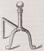
An iron utensil used, in Great Britain, where coal is the common fuel, to support the ends of a spit; but in America, used to support the wood in fire places.
Andocides
Encyclopedia Britannica
ANDOCIDES, a Greek orator and diplomatist, was born at Athens in 467, and died about 391 b.c. After holding a command for a time in the Athenian fleet, he was engaged in various embassies to foreign states. In 415 he was implicated with Alcibiades in the charge of mutilating the busts of Hermes, suspicion being specially roused against him from a large bust near his house having been almost the only one that was left entire. On the information he gave against others, they were put to death; and Andocides himself was deprived of his rights of citizenship, and went into exile. He returned to Athens on three different occasions, and though he was as many times driven again into banishment, he appears to have held a position of trust and influence in the city from 403 to 393. Three orations of his— Be Reditis, De Mysteriis, and De Pace— are extant, which are of great historical value. The authority of a fourth, Contra Alcibiadem, which has been attributed to him, is disputed on what appear to be good grounds. Andocides was one of the ten Attic orators, whose lives were written by Plutarch.
9th ed. Encyclopædia Britannica, vol. 2, p. 18
[195 words — estimated reading time: 2 minutes]
[195 words — estimated reading time: 2 minutes]
Addition Roget’s Thesaurus §37
N. addition, annexation, adjection, junction, superposition, superaddition, superjunction, superfetation, accession, reinforcement, increase, increment, supplement, accompaniment, interposition, insertion
V. add, annex, affix, superadd, subjoin, superpose, clap on, saddle on, tack to, append, tag, ingraft, saddle with, sprinkle, introduce, insert, become added, accrue, advene, supervene, reinforce, reenforce, restrengthen, swell the ranks of, augment
Adj. added, additional, supplemental, supplementary, suppletory, subjunctive, adjectitious, adscititious, ascititious, additive, extra, accessory
Adv. au reste, in addition, more, plus, extra, and, also, likewise, too, furthermore, further, item, and also, and eke, else, besides, to boot, et cetera, &c, and so on, and so forth, into the bargain, cum multis aliis, over and above, moreover, with, withal, including, inclusive, as well as, not to mention, let alone, together with, along with, coupled with, in conjunction with, conjointly, jointly
Phr. adde parvum parvo magnus acervus erit
Accompaniment Roget’s Thesaurus §88
N. accompaniment, adjunct, context, appendage, appurtenance, coexistence, concomitance, company, association, companionship, partnership, copartnership, coefficiency, concomitant, accessory, coefficient, companion, buddy, attendant, fellow, associate, friend, colleague, consort, spouse, mate, partner, co- partner, satellite, hanger on, fellow-traveller, shadow, escort, cortege, attribute
V. accompany, coexist, attend, hang on, wait on, go hand in hand with, synchronize, bear company, keep company, row in the same boat, bring in its train, associate with, couple with
Adj. accompanying, concomitant, fellow, twin, joint, associated with, coupled with, accessory, attendant, obbligato
Adv. with, withal, together with, along with, in company with, hand in hand, side by side, cheek by jowl, cheek by jole, arm in arm, therewith, herewith, and, together, in a body, collectively
Phr. noscitur a sociis, virtutis fortuna comes
King James Bible KJV Bible
Berean Standard Bible BSB Bible
28,365 KJV and 19,838 BSB verses contain “and” — showing the first 20. Show all 29,314 verses (searchable)
In the beginning God created the heaven and the earth.
In the beginning God created the heavens and the earth.
And the earth was without form, and void; and darkness was upon the face of the deep. And the Spirit of God moved upon the face of the waters.
Now the earth was formless and void, and darkness was over the surface of the deep. And the Spirit of God was hovering over the surface of the waters.
And God said, Let there be light: and there was light.
And God said, “Let there be light,” and there was light.
And God saw the light, that it was good: and God divided the light from the darkness.
And God saw that the light was good, and He separated the light from the darkness.
And God called the light Day, and the darkness he called Night. And the evening and the morning were the first day.
God called the light “day,” and the darkness He called “night.” And there was evening, and there was morning—the first day.
And God said, Let the waters under the heaven be gathered together unto one place, and let the dry land appear: and it was so.
And God said, “Let the waters under the sky be gathered into one place, so that the dry land may appear.” And it was so.
And God called the dry land Earth; and the gathering together of the waters called he Seas: and God saw that it was good.
God called the dry land “earth,” and the gathering of waters He called “seas.” And God saw that it was good.
And God said, Let the earth bring forth grass, the herb yielding seed, and the fruit tree yielding fruit after his kind, whose seed is in itself, upon the earth: and it was so.
Then God said, “Let the earth bring forth vegetation: seed-bearing plants and fruit trees, each bearing fruit with seed according to its kind.” And it was so.
And the earth brought forth grass, and herb yielding seed after his kind, and the tree yielding fruit, whose seed was in itself, after his kind: and God saw that it was good.
The earth produced vegetation: seed-bearing plants according to their kinds and trees bearing fruit with seed according to their kinds. And God saw that it was good.
And the evening and the morning were the third day.
And there was evening, and there was morning—the third day.
And God said, Let there be lights in the firmament of the heaven to divide the day from the night; and let them be for signs, and for seasons, and for days, and years:
And God said, “Let there be lights in the expanse of the sky to distinguish between the day and the night, and let them be signs to mark the seasons and days and years.
And God made two great lights; the greater light to rule the day, and the lesser light to rule the night: he made the stars also.
God made two great lights: the greater light to rule the day and the lesser light to rule the night. And He made the stars as well.
And to rule over the day and over the night, and to divide the light from the darkness: and God saw that it was good.
to preside over the day and the night, and to separate the light from the darkness. And God saw that it was good.
And the evening and the morning were the fourth day.
And there was evening, and there was morning—the fourth day.